The Ring Road is 1,322 kilometers, and you could drive it in three long days if all you wanted was to say you had. Nobody who has done it recommends that. Ten days is the length where the drive stops being the trip and Iceland starts being the trip: enough time to walk to the waterfalls instead of photographing them from the car park, and enough slack to sit out a storm without losing a hotel night.
This is a day-by-day route for ten days, with the overnight stops, the driving on each day and the detours we would skip. It assumes summer or the shoulder months. Winter is a different trip, and we explain why near the end.
The basics before you plan the days
The Ring Road is Route 1, a single loop that connects most of Iceland’s towns. Visit Iceland lists it at 1,322 km (820 miles), recommends at least seven days and says you do not need a 4×4 for it. That last point matters for your rental bill. A regular car is fine on Route 1 itself; you only need four-wheel drive for the highland F-roads, which are a separate trip and closed for most of the year.
A few things that shape every day of the itinerary:
- Speed limits are low. Generally 90 km/h on paved roads, 80 on gravel and 50 in towns. Distances that look short on the map take longer than you expect, especially with sheep, single-lane bridges and tour buses.
- Accommodation is the real constraint. Visit Iceland itself warns that rooms between Selfoss and Höfn are hard to find in peak summer. Book the south coast nights first, months ahead if you are going in July.
- Fuel is not a problem, but plan it anyway. Many stations are unstaffed pumps that take cards with a PIN. In the East, there are stretches where the next station is a long way off. Fill up when you pass a town with a half-empty tank.
- Check the roads every morning. Umferdin.is, run by the Icelandic Road Administration, shows live road conditions, and Safetravel posts weather and hazard alerts. It takes two minutes and it is the habit that keeps the trip safe.

Which direction to drive
You can leave Reykjavík heading east along the south coast or north toward Akureyri. Visit Iceland says there is no wrong way, and that is true. We go counterclockwise, south coast first, for a practical reason: the south coast holds the sights most people care about most (the waterfalls, the black beaches, the glacier lagoon), so you see them early, while the weather and your energy are still unknown quantities. If a storm costs you a day later in the trip, it costs you the north, which has more flexibility built in.
The 10-day route at a glance
| Day | Route | Overnight |
|---|---|---|
| 1 | Airport, Golden Circle | Selfoss or Hella area |
| 2 | South coast waterfalls and beaches | Vík |
| 3 | Skaftafell, Jökulsárlón | Höfn area |
| 4 | Eastfjords | Egilsstaðir |
| 5 | Seyðisfjörður and Stuðlagil canyon | Egilsstaðir |
| 6 | Dettifoss, on to Mývatn | Mývatn |
| 7 | Mývatn area, Goðafoss | Akureyri |
| 8 | Long drive west | Borgarnes area |
| 9 | Snæfellsnes peninsula | Snæfellsnes or Borgarnes |
| 10 | Back to Reykjavík, airport | Home or Reykjavík |
Day by day
Day 1: Golden Circle
Most flights from North America land early in the morning, which is the worst time to start driving. Pick up the car, get coffee, and keep the first day short. The Golden Circle (Þingvellir, the Geysir area and Gullfoss) is a loop close to Reykjavík, and you can do it on your way east instead of as a separate day trip. Sleep around Selfoss or Hella. Going to bed early on day one buys back the jet lag for the rest of the trip.
Day 2: South coast to Vík
This is the day of famous waterfalls. Seljalandsfoss, which you can walk behind, and Skógafoss sit right off the road. Then Dyrhólaey and the black sand at Reynisfjara before you reach Vík. The driving is short. The stops are what take the time, so do not book anything for the evening.
A warning that applies to Reynisfjara specifically: the waves there are dangerous and come up the beach much farther than they look like they will. Stay well back from the water, and never turn your back on it.
Day 3: Skaftafell and Jökulsárlón
The longest scenic day. You cross huge lava and sand plains to Skaftafell, part of Vatnajökull National Park, where a short hike gets you to Svartifoss and views of the glacier tongues. Then Jökulsárlón, the glacier lagoon, and the beach across the road where ice washes up on black sand. Sleep near Höfn.
Days 4 and 5: The Eastfjords
Höfn to Egilsstaðir follows the coast in and out of fjords, which is slow and beautiful. In summer, there is a shortcut over the Öxi pass (Route 939) that saves 68 km, but it is steep, winding gravel and Visit Iceland describes it as not for the faint of heart. If you are not comfortable on mountain gravel, take the coast. You lose an hour, not the day.
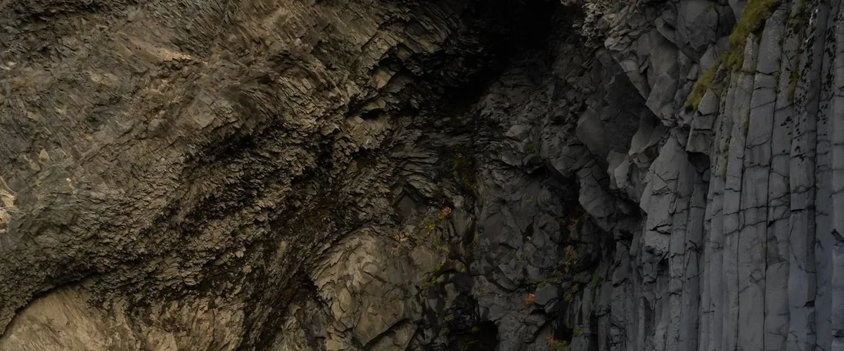
Spend two nights in Egilsstaðir and use day five for side trips: Seyðisfjörður, a small fjord town over a mountain pass, and the basalt columns of Stuðlagil canyon. This is the slack day. If the weather was bad on day three or four, this is where you absorb it.
Day 6: Dettifoss to Mývatn
Inland across the highland plateau. Dettifoss is the big one, and Visit Iceland groups it with the rest of the north as the Diamond Circle. Mývatn is a lake surrounded by volcanic landscape: craters, lava formations and steam vents. Sleep there, and plan an evening at the nature baths if you missed the more famous lagoon near the airport.
Day 7: Goðafoss and Akureyri
A short drive past Goðafoss to Akureyri, the largest town on the Ring Road. If you want a whale-watching trip, Húsavík is a detour north and is better known for it than Akureyri. The Vaðlaheiðargöng tunnel near Akureyri is a toll tunnel with no booths; you pay online at tunnel.is. Check your rental agreement, since some companies charge an extra fee if they have to pay it for you.
Day 8: The long drive west
Akureyri to the Borgarnes area is the longest driving day of the trip, roughly 310 km. Be honest about it: the scenery is good but not the best of the loop, and this is the day to drive rather than stop. Leave in the morning, take a long lunch somewhere in the middle, arrive in the late afternoon.
Day 9: Snæfellsnes
The Ring Road skips the west coast’s best scenery, which is why the Snæfellsnes peninsula is a detour worth a full day. The glacier on the volcano at the tip, Kirkjufell mountain, black churches and small harbor towns. If you would rather stay closer to the main road, the Hraunfossar waterfalls in Borgarfjörður are about 40 km off Route 1 and an easier alternative.
Day 10: Back to Reykjavík
About an hour from Borgarnes to Reykjavík, plus the drive out to the airport. If your flight is late, spend the day in the city. If it is early, sleep somewhere close to the airport on night nine instead of Snæfellsnes.
What to skip if you are short on time
Ten days has some slack built in. If you have eight, cut in this order:
- Snæfellsnes. Go straight from the north to Reykjavík and lose a day.
- The second Egilsstaðir night. Drive Höfn to Mývatn in two long days with one night in the East.
Do not cut the south coast to two days. It is the part people come for, and squeezing it means seeing Jökulsárlón in the rain from the parking lot.
Car, camper or hotels
A campervan is a popular way to do the Ring Road, and it does solve the accommodation problem on the south coast. The catch: overnight stays in vehicles are expected to be at campsites, not by the side of the road. The Environment Agency’s guide on where you can camp sets out the rules. Iceland’s access rights are much narrower than the Nordic right to roam described in our post on wild camping in Scandinavia, so do not assume the same rules apply.
If you go with a car and hotels, look carefully at the rental insurance. Gravel protection and sand and ash cover are sold as add-ons in Iceland for a reason. Our guide to the costs of renting a car in Europe covers the general traps, like deposit holds and fuel policies, that apply here too.
When to go, and why winter is a different trip
June to August is the easy version: long days, open roads and every service running. In midsummer it barely gets dark, which means you can drive in the evening and stop when you are tired rather than when the light runs out. May and September are quieter and cheaper, with somewhat more weather risk.
From roughly October to April, the Ring Road is still open, but the conditions change completely. Visit Iceland advises extra attention to road conditions in the north from September to May. Storms close stretches of road, daylight in December lasts only a few hours, and a fixed ten-day loop with a booked bed each night becomes a gamble. If you want winter Iceland for the northern lights, our northern lights trip guide makes the case for picking a base and staying put rather than driving a loop.
Whatever the season, save Iceland’s emergency number, 112. Safetravel also lists a backup number, 599-0112, for when a call to 112 does not connect.
Plan it once, then adjust on the road
A ten-day loop with a booked bed every night has one weak point: the day the weather or a closed road pushes you behind. When that happens, you want to see at a glance which bookings move and which do not. Lay out the route in Lentii with each overnight stop, the day’s driving and your booking details, and share it with whoever is in the car. Our Nordic road trip guide covers the same planning logic for Norway, Sweden and Denmark if you are combining trips.
FAQ
Is 10 days enough for the Iceland Ring Road?
Yes. Visit Iceland recommends at least seven days for the 1,322 km loop. Ten days lets you add Snæfellsnes and leaves one slack day for bad weather, which you will probably use.
Do I need a 4×4 for the Ring Road?
Not in summer. Route 1 is suitable for a regular car. You need four-wheel drive for the highland F-roads, and many travelers choose one in winter for extra grip and clearance.
Should I drive the Ring Road clockwise or counterclockwise?
Either works. Counterclockwise puts the south coast at the start of the trip, so you see the most popular sights before weather or fatigue can get in the way.